Dosya:T and O map Guntherus Ziner 1472.jpg
Bu önizlemenin boyutu: 600 × 600 piksel. Diğer çözünürlükler: 240 × 240 piksel | 480 × 480 piksel | 864 × 864 piksel.
Orijinal dosya (864 × 864 piksel, dosya boyutu: 279 KB, MIME türü: image/jpeg)
Özet
| Sanatçı/Yapan |
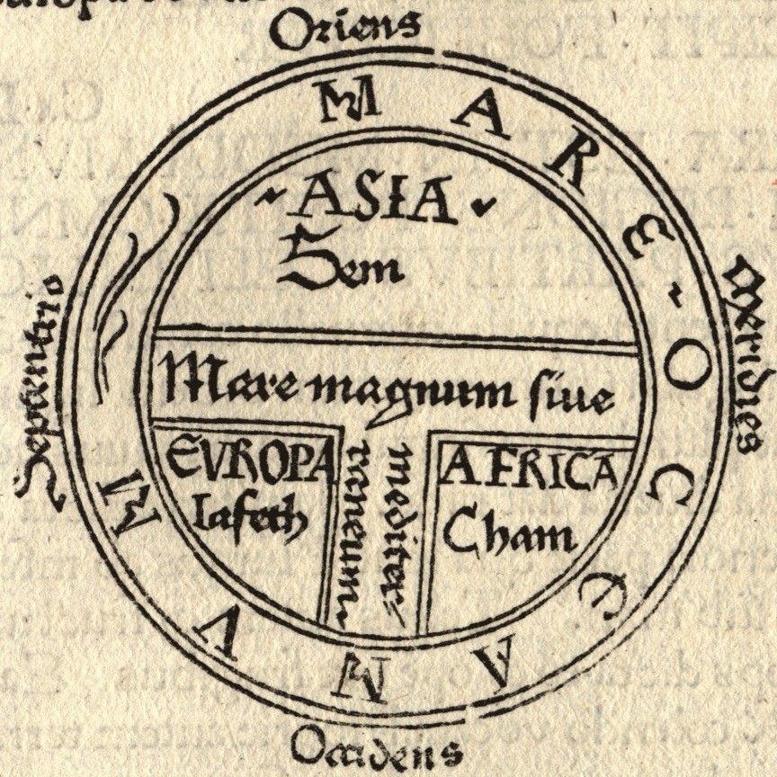
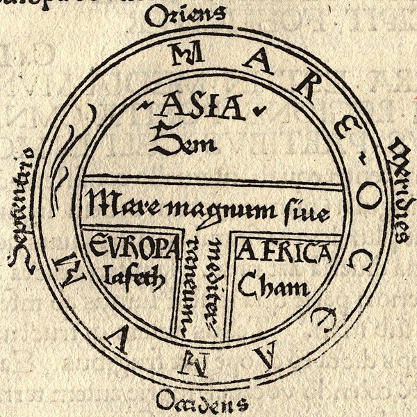
Isidore of Seville |
| Açıklama |
|
| Kaynak/Fotoğrafçı |

Lisanslama
|
Bu görüntüde gösterilmekte olan iki boyutlu sanat yapıtı,
Dolayısıyla, o sanat yapıtına ait bu tekrar üretim görüntüsü de kamu malıdır.
Tanımlanan durum, ABD (bakınız, Bridgeman Art Library v. Corel Corp. - Bridgeman Sanat Kütüphanesi Corel Şirketine karşı), Almanya ve diğer pek çok ülkede yaratılmış tekrar üretimler için geçerlidir.
| ||||
Dosya geçmişi
Dosyanın herhangi bir zamandaki hâli için ilgili tarih/saat kısmına tıklayın.
| Tarih/Saat | Küçük resim | Boyutlar | Kullanıcı | Yorum | |
|---|---|---|---|---|---|
| güncel | 00.43, 19 Ağustos 2006 | | 864 × 864 (279 KB) | wikimediacommons>Ma xyz | Reverted to earlier revision |